Découvrez la magnifique vallée du Haut-Verdon. À vos cotés pour l'organisation des séjours. Conseils pour de bonnes vacances en Verdon : activités, services et hébergements.
mis à jour le 03/03/2022 par Velo Loisir Provence
Langues parlées :
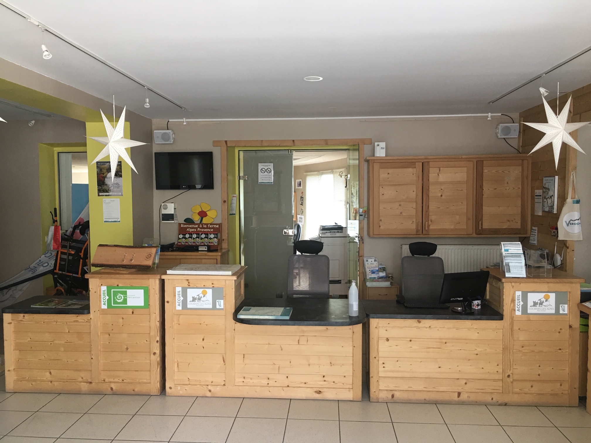
Le Bureau d'information touristique de Colmars-Les-Alpes vous accueille et vous conseille tout au long de l'année dans la magnifique vallée du Haut-Verdon dans le Parc naturel régional du Verdon.
N'hésitez pas à les contacter pour l’organisation de votre séjour.
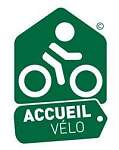
Labellisé "Accueil Vélo" et membre du réseau Vélo Loisir Provence, situé à proximités des itinéraires vélo et VTT, ils sauront vous accueillir et répondre à vos besoin de cyclistes. (documentation vélo, renseignements...).
Du 02/01 au 31/12.
Fermeture exceptionnelle le 25 décembre.
Avril et octobre
De 9h à 12h et de 14h à 18h
Fermé le dimanche
Jours fériés de 9h30 à 12h30
Mai, juin, à partir du 27 août et septembre
De 9h à 12h et de 14h à 18h
Dimanche et jours fériés de 9h30 à 12h30
Juillet jusqu'au 26 août
9h à 12h30 et de 14h à 18h30
De novembre à mars
De 10h à 12h et de 14h à 17h
Fermé le mardi, dimanche et les jours fériés
Vacances de Noël et de février zone B
ouvert tous les jours de 9h-12h et de 14h 18h.
array(1) {
["gpx"]=>
array(36) {
[0]=>
array(12) {
["id_Gpx"]=>
string(4) "1661"
["id_Objet"]=>
string(4) "3160"
["idPage"]=>
string(4) "9680"
["idLangue"]=>
string(1) "1"
["title"]=>
string(55) "VTT dans le Verdon - Circuit n°9 : Aiguines, Colmars "
["ancre"]=>
string(75) "Espace VTT-FFC - Des Sources aux Gorges du Verdon - Circuit n°9 : Aiguines"
["idImage"]=>
string(4) "8280"
["latitude"]=>
string(6) "6.6522"
["longitude"]=>
string(7) "44.1872"
["description"]=>
string(174) "Découvrez un circuit varié et sportif dans certains secteurs de la forêt. Vous pourrez observer le lys emblème de la vallée. A l'automne venez écouter le brame du cerf."
["url"]=>
string(24) "/page/aiguines+9680.html"
["colorGPX"]=>
string(7) "#3388ff"
}
[1]=>
array(12) {
["id_Gpx"]=>
string(4) "1661"
["id_Objet"]=>
string(4) "3160"
["idPage"]=>
string(4) "9681"
["idLangue"]=>
string(1) "2"
["title"]=>
string(13) "Aiguines - EN"
["ancre"]=>
string(13) "Aiguines - EN"
["idImage"]=>
string(4) "8280"
["latitude"]=>
string(6) "6.6522"
["longitude"]=>
string(7) "44.1872"
["description"]=>
string(249) "In the shade of the larches, a varied circuit on the red trail of the Ratery Nordic area. The loop is a little more challenging in some parts of the forest. See the lily, emblem of the valley. In autumn, come and listen to the bellowing of the stag."
["url"]=>
string(29) "/page/aiguines---en+9681.html"
["colorGPX"]=>
string(7) "#3388ff"
}
[2]=>
array(12) {
["id_Gpx"]=>
string(4) "1661"
["id_Objet"]=>
string(4) "3160"
["idPage"]=>
string(4) "9682"
["idLangue"]=>
string(1) "3"
["title"]=>
string(48) "Mountainbike-Route im Verdon - Aiguines, Colmars"
["ancre"]=>
string(8) "Aiguines"
["idImage"]=>
string(4) "8280"
["latitude"]=>
string(6) "6.6522"
["longitude"]=>
string(7) "44.1872"
["description"]=>
string(216) "Entdecken Sie eine abwechslungsreiche und sportliche Strecke in bestimmten Bereichen des Waldes. Sie können das Lilien-Emblem des Tals beobachten. Im Herbst kommen Sie und hören Sie sich die Platte des Hirsches an."
["url"]=>
string(29) "/page/aiguines---de+9682.html"
["colorGPX"]=>
string(7) "#3388ff"
}
[3]=>
array(12) {
["id_Gpx"]=>
string(4) "1660"
["id_Objet"]=>
string(4) "3159"
["idPage"]=>
string(4) "9677"
["idLangue"]=>
string(1) "1"
["title"]=>
string(56) "VTT dans le Verdon - Circuit n°11 : Bla Magnan, Colmars"
["ancre"]=>
string(78) "Espace VTT-FFC - Des Sources aux Gorges du Verdon - Circuit n°11 : Bla Magnan"
["idImage"]=>
string(4) "8279"
["latitude"]=>
string(7) "6.62612"
["longitude"]=>
string(7) "44.1806"
["description"]=>
string(151) "Prenez de la hauteur à Bla Magnan et découvrez Colmars sous un autre angle. Grande traversée sur la piste forestière qui domine le cours du Verdon."
["url"]=>
string(26) "/page/bla-magnan+9677.html"
["colorGPX"]=>
string(7) "#3388ff"
}
[4]=>
array(12) {
["id_Gpx"]=>
string(4) "1660"
["id_Objet"]=>
string(4) "3159"
["idPage"]=>
string(4) "9678"
["idLangue"]=>
string(1) "2"
["title"]=>
string(15) "Bla Magnan - EN"
["ancre"]=>
string(15) "Bla Magnan - EN"
["idImage"]=>
string(4) "8279"
["latitude"]=>
string(7) "6.62612"
["longitude"]=>
string(7) "44.1806"
["description"]=>
string(210) "Gain height at Bla Magnan and discover Colmars from another angle. Cross over to the forest track overlooking the course of the Verdon and descend through the Scots pines. Return to the left bank of the Verdon."
["url"]=>
string(31) "/page/bla-magnan---en+9678.html"
["colorGPX"]=>
string(7) "#3388ff"
}
[5]=>
array(12) {
["id_Gpx"]=>
string(4) "1660"
["id_Objet"]=>
string(4) "3159"
["idPage"]=>
string(4) "9679"
["idLangue"]=>
string(1) "3"
["title"]=>
string(50) "Mountainbike-Route im Verdon - Bla Magnan, Colmars"
["ancre"]=>
string(11) "Blah Magnan"
["idImage"]=>
string(4) "8279"
["latitude"]=>
string(7) "6.62612"
["longitude"]=>
string(7) "44.1806"
["description"]=>
string(167) "Steigen Sie in Bla Magnan in die Höhe und entdecken Sie Colmars aus einer anderen Perspektive. Tolle Überfahrt auf dem Waldweg, der den Verlauf des Verdon dominiert."
["url"]=>
string(31) "/page/bla-magnan---de+9679.html"
["colorGPX"]=>
string(7) "#3388ff"
}
[6]=>
array(12) {
["id_Gpx"]=>
string(4) "1663"
["id_Objet"]=>
string(4) "3162"
["idPage"]=>
string(4) "9686"
["idLangue"]=>
string(1) "1"
["title"]=>
string(69) "Itinéraire VTT dans le Verdon - Circuit n°7 : Cabane neuve, Colmars"
["ancre"]=>
string(79) "Espace VTT-FFC - Des Sources aux Gorges du Verdon - Circuit n°7 : Cabane Neuve"
["idImage"]=>
string(4) "8282"
["latitude"]=>
string(7) "6.65265"
["longitude"]=>
string(7) "44.1872"
["description"]=>
string(163) "Au départ du chalet de Ratery, les pistes sont tracés dans une grande forêt de mélèzes, le circuit emprunte la boucle de "La Reynière" jusqu'à Cabane Neuve."
["url"]=>
string(28) "/page/cabane-neuve+9686.html"
["colorGPX"]=>
string(7) "#3388ff"
}
[7]=>
array(12) {
["id_Gpx"]=>
string(4) "1663"
["id_Objet"]=>
string(4) "3162"
["idPage"]=>
string(4) "9687"
["idLangue"]=>
string(1) "2"
["title"]=>
string(17) "Cabane neuve - EN"
["ancre"]=>
string(17) "Cabane neuve - EN"
["idImage"]=>
string(4) "8282"
["latitude"]=>
string(7) "6.65265"
["longitude"]=>
string(7) "44.1872"
["description"]=>
string(159) "Departing from the Chalet de Ratery, a Nordic center in winter, the trails run through a large larch forest, following the "La Reynière" loop to Cabane Neuve."
["url"]=>
string(33) "/page/cabane-neuve---en+9687.html"
["colorGPX"]=>
string(7) "#3388ff"
}
[8]=>
array(12) {
["id_Gpx"]=>
string(4) "1663"
["id_Objet"]=>
string(4) "3162"
["idPage"]=>
string(4) "9688"
["idLangue"]=>
string(1) "3"
["title"]=>
string(51) "Mountainbike-Route im Verdon - Neue Hütte, Colmars"
["ancre"]=>
string(11) "Neue Kabine"
["idImage"]=>
string(4) "8282"
["latitude"]=>
string(7) "6.65265"
["longitude"]=>
string(7) "44.1872"
["description"]=>
string(159) "Ausgehend vom Ratery-Chalet werden die Hänge in einem großen Lärchenwald verfolgt, der Rundgang folgt der Schleife von „La Reynière“ nach Cabane Neuve."
["url"]=>
string(33) "/page/cabane-neuve---de+9688.html"
["colorGPX"]=>
string(7) "#3388ff"
}
[9]=>
array(12) {
["id_Gpx"]=>
string(4) "1652"
["id_Objet"]=>
string(4) "3151"
["idPage"]=>
string(4) "9653"
["idLangue"]=>
string(1) "1"
["title"]=>
string(78) "Itinéraire VTT dans le Verdon - Circuit n°23-23 : Chassette, Villars-Colmars"
["ancre"]=>
string(80) "Espace VTT-FFC - Des Sources aux Gorges du Verdon - Circuit n°23-23 : Chassette"
["idImage"]=>
string(4) "8271"
["latitude"]=>
string(7) "6.60682"
["longitude"]=>
string(7) "44.1687"
["description"]=>
string(173) "Le circuit prend la rive gauche de la Chasse à travers les noisetiers avec une vue surprenante où on découvre le hameau. Ce village a affronté les contraintes du temps. "
["url"]=>
string(25) "/page/chassette+9653.html"
["colorGPX"]=>
string(7) "#3388ff"
}
[10]=>
array(12) {
["id_Gpx"]=>
string(4) "1652"
["id_Objet"]=>
string(4) "3151"
["idPage"]=>
string(4) "9654"
["idLangue"]=>
string(1) "2"
["title"]=>
string(14) "Chassette - EN"
["ancre"]=>
string(14) "Chassette - EN"
["idImage"]=>
string(4) "8271"
["latitude"]=>
string(7) "6.60682"
["longitude"]=>
string(7) "44.1687"
["description"]=>
string(233) "Hunting loop enhanced. Cross the hamlet, a living testimony to a mountain village that has withstood the test of time. The circuit takes in the left bank of the Chasse through the hazelnut trees, with a surprising view of the hamlet."
["url"]=>
string(30) "/page/chassette---en+9654.html"
["colorGPX"]=>
string(7) "#3388ff"
}
[11]=>
array(12) {
["id_Gpx"]=>
string(4) "1652"
["id_Objet"]=>
string(4) "3151"
["idPage"]=>
string(4) "9655"
["idLangue"]=>
string(1) "3"
["title"]=>
string(57) "Mountainbike-Route im Verdon - Chassette, Villars-Colmars"
["ancre"]=>
string(9) "Chassette"
["idImage"]=>
string(4) "8271"
["latitude"]=>
string(7) "6.60682"
["longitude"]=>
string(7) "44.1687"
["description"]=>
string(192) "Die Rennstrecke führt am linken Ufer von La Chasse durch die Haselbäume mit einer überraschenden Aussicht, wo wir den Weiler entdecken. Dieses Dorf war mit Zeitbeschränkungen konfrontiert."
["url"]=>
string(30) "/page/chassette---de+9655.html"
["colorGPX"]=>
string(7) "#3388ff"
}
[12]=>
array(12) {
["id_Gpx"]=>
string(3) "213"
["id_Objet"]=>
string(3) "860"
["idPage"]=>
string(4) "2756"
["idLangue"]=>
string(1) "1"
["title"]=>
string(69) "Transverdon tronçon 1 - Du Col d’Allos à Val d’Allos Le Village"
["ancre"]=>
string(69) "Transverdon tronçon 1 - Du Col d’Allos à Val d’Allos Le Village"
["idImage"]=>
string(4) "2000"
["latitude"]=>
string(6) "6.5946"
["longitude"]=>
string(6) "44.297"
["description"]=>
string(166) "Le premier tronçon de l'itinéraire de la Grande Traversée VTT TransVerdon débute au Col d'Allos au Val d'Allos - Le Village par une superbe descente en sous-bois."
["url"]=>
string(27) "/page/transverdon-troncon-1"
["colorGPX"]=>
string(7) "#e52713"
}
[13]=>
array(12) {
["id_Gpx"]=>
string(3) "213"
["id_Objet"]=>
string(3) "860"
["idPage"]=>
string(4) "2757"
["idLangue"]=>
string(1) "2"
["title"]=>
string(70) "Transverdon stretch 1 - From the Col d'Allos to Val d'Allos Le Village"
["ancre"]=>
string(69) "Transverdon tronçon 1 - Du Col d’Allos à Val d’Allos Le Village"
["idImage"]=>
string(4) "2000"
["latitude"]=>
string(6) "6.5946"
["longitude"]=>
string(6) "44.297"
["description"]=>
string(158) "The first stretch of the TransVerdon Mountain Bike Traverse route starts at the Col d'Allos in the Val d'Allos - Le Village with a superb undergrowth descent."
["url"]=>
string(84) "/page/transverdon-troncon-1---du-col-d-allos-a-val-d-allos-le-village---en+2757.html"
["colorGPX"]=>
string(7) "#e52713"
}
[14]=>
array(12) {
["id_Gpx"]=>
string(3) "213"
["id_Objet"]=>
string(3) "860"
["idPage"]=>
string(4) "2758"
["idLangue"]=>
string(1) "3"
["title"]=>
string(66) "Transverdon Abschnitt 1 - Von Col d'Allos zum Val d'Allos Das Dorf"
["ancre"]=>
string(69) "Transverdon tronçon 1 - Du Col d’Allos à Val d’Allos Le Village"
["idImage"]=>
string(4) "2000"
["latitude"]=>
string(6) "6.5946"
["longitude"]=>
string(6) "44.297"
["description"]=>
string(156) "Der erste Abschnitt der MTB-Strecke TransverDon Great Crossing beginnt am Col d'Allos in Val d'Allos - Le Village mit einer herrlichen Abfahrt im Unterholz."
["url"]=>
string(84) "/page/transverdon-troncon-1---du-col-d-allos-a-val-d-allos-le-village---de+2758.html"
["colorGPX"]=>
string(7) "#e52713"
}
[15]=>
array(12) {
["id_Gpx"]=>
string(5) "14031"
["id_Objet"]=>
string(4) "5651"
["idPage"]=>
string(5) "17200"
["idLangue"]=>
string(1) "1"
["title"]=>
string(36) "Grande Traversée VTT La TransVerdon"
["ancre"]=>
string(36) "Grande Traversée VTT La TransVerdon"
["idImage"]=>
string(5) "15613"
["latitude"]=>
string(7) "6.14784"
["longitude"]=>
string(6) "43.764"
["description"]=>
string(267) "« La TransVerdon » débute aux sources du Verdon, au col d’Allos, situé à 2.247 m d’altitude. Il s’agit d’un voyage de 260 km entre ces montagnes alpines et Gréoux-les-Bains, résolument complet et technique, ponctué de pauses baignades bien méritées."
["url"]=>
string(52) "/page/grande-traversee-vtt-la-transverdon+17200.html"
["colorGPX"]=>
string(7) "#3388ff"
}
[16]=>
array(12) {
["id_Gpx"]=>
string(5) "14031"
["id_Objet"]=>
string(4) "5651"
["idPage"]=>
string(5) "17201"
["idLangue"]=>
string(1) "2"
["title"]=>
string(41) "Grande Traversée VTT La TransVerdon - EN"
["ancre"]=>
string(41) "Grande Traversée VTT La TransVerdon - EN"
["idImage"]=>
string(5) "15613"
["latitude"]=>
string(7) "6.14784"
["longitude"]=>
string(6) "43.764"
["description"]=>
string(253) ""The TransVerdon begins at the source of the Verdon, at the Col d'Allos, 2,247 m above sea level. It's a 260 km journey between these Alpine mountains and Gréoux-les-Bains, resolutely complete and technical, punctuated by well-deserved swimming breaks."
["url"]=>
string(57) "/page/grande-traversee-vtt-la-transverdon---en+17201.html"
["colorGPX"]=>
string(7) "#3388ff"
}
[17]=>
array(12) {
["id_Gpx"]=>
string(5) "14031"
["id_Objet"]=>
string(4) "5651"
["idPage"]=>
string(5) "17202"
["idLangue"]=>
string(1) "3"
["title"]=>
string(41) "Grande Traversée VTT La TransVerdon - DE"
["ancre"]=>
string(41) "Grande Traversée VTT La TransVerdon - DE"
["idImage"]=>
string(5) "15613"
["latitude"]=>
string(7) "6.14784"
["longitude"]=>
string(6) "43.764"
["description"]=>
string(0) ""
["url"]=>
string(57) "/page/grande-traversee-vtt-la-transverdon---de+17202.html"
["colorGPX"]=>
string(7) "#3388ff"
}
[18]=>
array(12) {
["id_Gpx"]=>
string(4) "1651"
["id_Objet"]=>
string(4) "3150"
["idPage"]=>
string(4) "9650"
["idLangue"]=>
string(1) "1"
["title"]=>
string(81) "Itinéraire VTT dans le Verdon - Circuit n°24 : La Croix du Puy, Villars-Colmars"
["ancre"]=>
string(83) "Espace VTT-FFC - Des Sources aux Gorges du Verdon - Circuit n°24 : La Croix du Puy"
["idImage"]=>
string(4) "8270"
["latitude"]=>
string(7) "6.60682"
["longitude"]=>
string(7) "44.1684"
["description"]=>
string(162) "Suivez le parcours 23 et prenez la direction de la Croix du Puy, ici un arrêt s'impose avec un point de vue remarquable sur la vallée et les villages du Verdon."
["url"]=>
string(31) "/page/la-croix-du-puy+9650.html"
["colorGPX"]=>
string(7) "#3388ff"
}
[19]=>
array(12) {
["id_Gpx"]=>
string(4) "1651"
["id_Objet"]=>
string(4) "3150"
["idPage"]=>
string(4) "9651"
["idLangue"]=>
string(1) "2"
["title"]=>
string(20) "La Croix du Puy - EN"
["ancre"]=>
string(20) "La Croix du Puy - EN"
["idImage"]=>
string(4) "8270"
["latitude"]=>
string(7) "6.60682"
["longitude"]=>
string(7) "44.1684"
["description"]=>
string(151) "From the kiosk, follow route 23 and before the huts, head for the Croix du Puy, where you'll enjoy a remarkable view of the valley and Verdon villages."
["url"]=>
string(36) "/page/la-croix-du-puy---en+9651.html"
["colorGPX"]=>
string(7) "#3388ff"
}
[20]=>
array(12) {
["id_Gpx"]=>
string(4) "1651"
["id_Objet"]=>
string(4) "3150"
["idPage"]=>
string(4) "9652"
["idLangue"]=>
string(1) "3"
["title"]=>
string(63) "Mountainbike-Route im Verdon - La Croix du Puy, Villars-Colmars"
["ancre"]=>
string(15) "La Croix du Puy"
["idImage"]=>
string(4) "8270"
["latitude"]=>
string(7) "6.60682"
["longitude"]=>
string(7) "44.1684"
["description"]=>
string(172) "Folgen Sie der Route 23 und fahren Sie in Richtung La Croix du Puy. Hier ist ein Stopp mit einem bemerkenswerten Blick auf das Tal und die Dörfer des Verdon unerlässlich."
["url"]=>
string(36) "/page/la-croix-du-puy---de+9652.html"
["colorGPX"]=>
string(7) "#3388ff"
}
[21]=>
array(12) {
["id_Gpx"]=>
string(4) "1662"
["id_Objet"]=>
string(4) "3161"
["idPage"]=>
string(4) "9683"
["idLangue"]=>
string(1) "1"
["title"]=>
string(57) "VTT dans le Verdon - Circuit n°8 - La Reynière, Colmars"
["ancre"]=>
string(102) "Espace VTT-FFC - Des Sources aux Gorges du Verdon - Circuit n°8 : Reynière (Haut-Verdon Val d'Allos)"
["idImage"]=>
string(4) "8281"
["latitude"]=>
string(7) "6.65258"
["longitude"]=>
string(7) "44.1871"
["description"]=>
string(159) "Découvrez un itinéraire varié et assez sportif sur le domaine nordique de Ratery à Colmars dans le Verdon. La circuit passe à proximité de Cabane Vieille"
["url"]=>
string(27) "/page/la-reyniere+9683.html"
["colorGPX"]=>
string(7) "#3388ff"
}
[22]=>
array(12) {
["id_Gpx"]=>
string(4) "1662"
["id_Objet"]=>
string(4) "3161"
["idPage"]=>
string(4) "9684"
["idLangue"]=>
string(1) "2"
["title"]=>
string(17) "La Reynière - EN"
["ancre"]=>
string(17) "La Reynière - EN"
["idImage"]=>
string(4) "8281"
["latitude"]=>
string(7) "6.65258"
["longitude"]=>
string(7) "44.1871"
["description"]=>
string(101) "A varied and fairly sporty route in the Ratery Nordic area. The route passes close to Cabane Vieille."
["url"]=>
string(32) "/page/la-reyniere---en+9684.html"
["colorGPX"]=>
string(7) "#3388ff"
}
[23]=>
array(12) {
["id_Gpx"]=>
string(4) "1662"
["id_Objet"]=>
string(4) "3161"
["idPage"]=>
string(4) "9685"
["idLangue"]=>
string(1) "3"
["title"]=>
string(52) "Mountainbike-Route im Verdon - La Reynière, Colmars"
["ancre"]=>
string(12) "La Reynière"
["idImage"]=>
string(4) "8281"
["latitude"]=>
string(7) "6.65258"
["longitude"]=>
string(7) "44.1871"
["description"]=>
string(180) "Entdecken Sie eine abwechslungsreiche und recht sportliche Reiseroute im nordischen Skigebiet Ratery in Colmars im Verdon. Die Rennstrecke verläuft in der Nähe von Cabane Vieille"
["url"]=>
string(32) "/page/la-reyniere---de+9685.html"
["colorGPX"]=>
string(7) "#3388ff"
}
[24]=>
array(12) {
["id_Gpx"]=>
string(4) "1648"
["id_Objet"]=>
string(4) "3147"
["idPage"]=>
string(4) "9641"
["idLangue"]=>
string(1) "1"
["title"]=>
string(75) "Itinéraire VTT dans le Verdon -Circuit n°10 : La traversée des Baussées"
["ancre"]=>
string(94) "Espace VTT-FFC - Des Sources aux Gorges du Verdon - Circuit n°10 : La Traversée des Baussée"
["idImage"]=>
string(4) "8267"
["latitude"]=>
string(7) "6.62784"
["longitude"]=>
string(7) "44.1822"
["description"]=>
string(149) "Au départ de Colmars, profitez d'un parcours sportif en empruntant la route du col des Champs qui serpente jusqu'au départ du sentier de Noncière."
["url"]=>
string(41) "/page/la-traversee-des-baussees+9641.html"
["colorGPX"]=>
string(7) "#3388ff"
}
[25]=>
array(12) {
["id_Gpx"]=>
string(4) "1648"
["id_Objet"]=>
string(4) "3147"
["idPage"]=>
string(4) "9642"
["idLangue"]=>
string(1) "2"
["title"]=>
string(32) "La traversée des Baussées - EN"
["ancre"]=>
string(32) "La traversée des Baussées - EN"
["idImage"]=>
string(4) "8267"
["latitude"]=>
string(7) "6.62784"
["longitude"]=>
string(7) "44.1822"
["description"]=>
string(244) "Departing from Colmars, a picturesque fortified village, this challenging route takes you along the Col des Champs road, which winds its way to the start of the Noncière trail. Serious climbs with exceptional views over the Haut-Verdon valley."
["url"]=>
string(46) "/page/la-traversee-des-baussees---en+9642.html"
["colorGPX"]=>
string(7) "#3388ff"
}
[26]=>
array(12) {
["id_Gpx"]=>
string(4) "1648"
["id_Objet"]=>
string(4) "3147"
["idPage"]=>
string(4) "9643"
["idLangue"]=>
string(1) "3"
["title"]=>
string(57) "Mountainbike-Route im Verdon - Überquerung der Baussées"
["ancre"]=>
string(25) "Die Baussées überqueren"
["idImage"]=>
string(4) "8267"
["latitude"]=>
string(7) "6.62784"
["longitude"]=>
string(7) "44.1822"
["description"]=>
string(149) "Genießen Sie von Colmars aus eine sportliche Route, indem Sie die Straße Col des Champs nehmen, die sich bis zum Beginn des Noncière-Weges windet."
["url"]=>
string(46) "/page/la-traversee-des-baussees---de+9643.html"
["colorGPX"]=>
string(7) "#3388ff"
}
[27]=>
array(12) {
["id_Gpx"]=>
string(4) "1649"
["id_Objet"]=>
string(4) "3148"
["idPage"]=>
string(4) "9644"
["idLangue"]=>
string(1) "1"
["title"]=>
string(83) "VTT dans le Verdon - Circuit n°12b - Les Balcons de Pinatelle par Villars-Heyssier"
["ancre"]=>
string(101) "Espace VTT-FFC - Des Sources aux Gorges du Verdon - Circuit n°12b : Les balcons de Pinatelle par Vil"
["idImage"]=>
string(4) "8268"
["latitude"]=>
string(7) "6.59686"
["longitude"]=>
string(7) "44.1289"
["description"]=>
string(160) "A partir du pont de Villars-Heyssier une grande boucle avec de beaux panoramas sur la piste forestière et des traversées en sous-bois en rive gauche du Verdon"
["url"]=>
string(61) "/page/les-balcons-de-pinatelle-par-villars-heyssier+9644.html"
["colorGPX"]=>
string(7) "#3388ff"
}
[28]=>
array(12) {
["id_Gpx"]=>
string(4) "1649"
["id_Objet"]=>
string(4) "3148"
["idPage"]=>
string(4) "9645"
["idLangue"]=>
string(1) "2"
["title"]=>
string(50) "Les Balcons de Pinatelle par Villars-Heyssier - EN"
["ancre"]=>
string(50) "Les Balcons de Pinatelle par Villars-Heyssier - EN"
["idImage"]=>
string(4) "8268"
["latitude"]=>
string(7) "6.59686"
["longitude"]=>
string(7) "44.1289"
["description"]=>
string(148) "From the Villars-Heyssier bridge, a long loop with beautiful panoramas on the forest track and undergrowth crossings on the left bank of the Verdon."
["url"]=>
string(66) "/page/les-balcons-de-pinatelle-par-villars-heyssier---en+9645.html"
["colorGPX"]=>
string(7) "#3388ff"
}
[29]=>
array(12) {
["id_Gpx"]=>
string(4) "1649"
["id_Objet"]=>
string(4) "3148"
["idPage"]=>
string(4) "9646"
["idLangue"]=>
string(1) "3"
["title"]=>
string(59) "MTB-Strecke - Les Balcons de Pinatelle von Villars-Heyssier"
["ancre"]=>
string(46) "Die Balkone der Pinatelle von Villars-Heyssier"
["idImage"]=>
string(4) "8268"
["latitude"]=>
string(7) "6.59686"
["longitude"]=>
string(7) "44.1289"
["description"]=>
string(144) "Von der Villars-Heyssier-Brücke eine große Schleife mit schönen Panoramen auf dem Waldweg und Unterholzübergängen am linken Ufer des Verdon"
["url"]=>
string(66) "/page/les-balcons-de-pinatelle-par-villars-heyssier---de+9646.html"
["colorGPX"]=>
string(7) "#3388ff"
}
[30]=>
array(12) {
["id_Gpx"]=>
string(4) "1650"
["id_Objet"]=>
string(4) "3149"
["idPage"]=>
string(4) "9647"
["idLangue"]=>
string(1) "1"
["title"]=>
string(74) "VTT dans le Verdon - Circuit n°12a - Les Balcons de Pinatelle par Colmars"
["ancre"]=>
string(101) "Espace VTT-FFC - Des Sources aux Gorges du Verdon - Circuit n°12a : Les balcons de Pinatelle par Col"
["idImage"]=>
string(4) "8269"
["latitude"]=>
string(7) "6.62711"
["longitude"]=>
string(6) "44.182"
["description"]=>
string(159) "Au départ de Colmars dirigez vous vers le hameau de Villars-Heyssier, départ d'une remarquable randonnée dans les Gorges de St Pierre, uniquement pédestre."
["url"]=>
string(52) "/page/les-balcons-de-pinatelle-par-colmars+9647.html"
["colorGPX"]=>
string(7) "#3388ff"
}
[31]=>
array(12) {
["id_Gpx"]=>
string(4) "1650"
["id_Objet"]=>
string(4) "3149"
["idPage"]=>
string(4) "9648"
["idLangue"]=>
string(1) "2"
["title"]=>
string(41) "Les Balcons de Pinatelle par Colmars - EN"
["ancre"]=>
string(41) "Les Balcons de Pinatelle par Colmars - EN"
["idImage"]=>
string(4) "8269"
["latitude"]=>
string(7) "6.62711"
["longitude"]=>
string(6) "44.182"
["description"]=>
string(162) "From Colmars, you can enhance route no. 12 by heading for the hamlet of Villars-Heyssier, the start of a remarkable hike in the Gorges de St Pierre, on foot only."
["url"]=>
string(57) "/page/les-balcons-de-pinatelle-par-colmars---en+9648.html"
["colorGPX"]=>
string(7) "#3388ff"
}
[32]=>
array(12) {
["id_Gpx"]=>
string(4) "1650"
["id_Objet"]=>
string(4) "3149"
["idPage"]=>
string(4) "9649"
["idLangue"]=>
string(1) "3"
["title"]=>
string(50) "MTB-Strecke - Les Balcons de Pinatelle von Colmars"
["ancre"]=>
string(37) "Die Balkone der Pinatelle von Colmars"
["idImage"]=>
string(4) "8269"
["latitude"]=>
string(7) "6.62711"
["longitude"]=>
string(6) "44.182"
["description"]=>
string(132) "Von Colmars geht es zum Weiler Villars-Heyssier, dem Beginn einer bemerkenswerten Wanderung in den Gorges de St Pierre, nur zu Fuß."
["url"]=>
string(57) "/page/les-balcons-de-pinatelle-par-colmars---de+9649.html"
["colorGPX"]=>
string(7) "#3388ff"
}
[33]=>
array(12) {
["id_Gpx"]=>
string(4) "1659"
["id_Objet"]=>
string(4) "3158"
["idPage"]=>
string(4) "9674"
["idLangue"]=>
string(1) "1"
["title"]=>
string(59) "VTT dans le Verdon - Circuit n°12 : Ondres, Beauvezer (04)"
["ancre"]=>
string(74) "Espace VTT-FFC - Des Sources aux Gorges du Verdon - Circuit n°12 : Ondres"
["idImage"]=>
string(4) "8278"
["latitude"]=>
string(7) "6.58907"
["longitude"]=>
string(7) "44.1385"
["description"]=>
string(171) "Au départ du pont de Villars-Heyssier, un circuit magnifique à flanc de montagne en direction du plan de Beauvezer et du hameau d'Ondres. Un joli panorama vous attends !"
["url"]=>
string(22) "/page/ondres+9674.html"
["colorGPX"]=>
string(7) "#3388ff"
}
[34]=>
array(12) {
["id_Gpx"]=>
string(4) "1659"
["id_Objet"]=>
string(4) "3158"
["idPage"]=>
string(4) "9675"
["idLangue"]=>
string(1) "2"
["title"]=>
string(11) "Ondres - EN"
["ancre"]=>
string(11) "Ondres - EN"
["idImage"]=>
string(4) "8278"
["latitude"]=>
string(7) "6.58907"
["longitude"]=>
string(7) "44.1385"
["description"]=>
string(182) "From the Villars-Heyssier bridge, a magnificent circuit along the mountainside towards the Plan de Beauvezer and the hamlet of Ondres. Return with a beautiful panorama of the Verdon."
["url"]=>
string(27) "/page/ondres---en+9675.html"
["colorGPX"]=>
string(7) "#3388ff"
}
[35]=>
array(12) {
["id_Gpx"]=>
string(4) "1659"
["id_Objet"]=>
string(4) "3158"
["idPage"]=>
string(4) "9676"
["idLangue"]=>
string(1) "3"
["title"]=>
string(53) "Mountainbike-Route im Verdon - Ondres, Beauvazer (04)"
["ancre"]=>
string(6) "Ondres"
["idImage"]=>
string(4) "8278"
["latitude"]=>
string(7) "6.58907"
["longitude"]=>
string(7) "44.1385"
["description"]=>
string(164) "Ausgehend von der Villars-Heyssier-Brücke, einer herrlichen Strecke am Berghang zum Plan de Beauvezer und dem Weiler Ondres. Ein schönes Panorama wartet auf dich!"
["url"]=>
string(27) "/page/ondres---de+9676.html"
["colorGPX"]=>
string(7) "#3388ff"
}
}
}
Découvrez un circuit varié et sportif dans certains secteurs de la forêt. Vous pourrez observer le lys emblème de la vallée. A l'automne venez écouter le brame du cerf.
Au départ du chalet de Ratery, les pistes sont tracés dans une grande forêt de mélèzes, le circuit emprunte la boucle de "La Reynière" jusqu'à Cabane Neuve.
Le circuit prend la rive gauche de la Chasse à travers les noisetiers avec une vue surprenante où on découvre le hameau. Ce village a affronté les contraintes du temps.
Le premier tronçon de l'itinéraire de la Grande Traversée VTT TransVerdon débute au Col d'Allos au Val d'Allos - Le Village par une superbe descente en sous-bois.
« La TransVerdon » débute aux sources du Verdon, au col d’Allos, situé à 2.247 m d’altitude. Il s’agit d’un voyage de 260 km entre ces montagnes alpines et Gréoux-les-Bains, résolument complet et technique, ponctué de pauses baignades bien méritées.
Suivez le parcours 23 et prenez la direction de la Croix du Puy, ici un arrêt s'impose avec un point de vue remarquable sur la vallée et les villages du Verdon.
Découvrez un itinéraire varié et assez sportif sur le domaine nordique de Ratery à Colmars dans le Verdon. La circuit passe à proximité de Cabane Vieille
A partir du pont de Villars-Heyssier une grande boucle avec de beaux panoramas sur la piste forestière et des traversées en sous-bois en rive gauche du Verdon
Au départ de Colmars dirigez vous vers le hameau de Villars-Heyssier, départ d'une remarquable randonnée dans les Gorges de St Pierre, uniquement pédestre.
Au départ du pont de Villars-Heyssier, un circuit magnifique à flanc de montagne en direction du plan de Beauvezer et du hameau d'Ondres. Un joli panorama vous attends !